


The biggest wayfinding problems often aren’t caused by missing signs. They happen when the physical workplace and the information describing it fall out of sync.
A meeting room gets renamed, but the old name remains on a digital map. A floor is reconfigured for flexible seating while the lobby directory still reflects the previous layout. An employee reserves a workspace successfully, then arrives without an easy way to find it. Each interaction works in isolation, yet the overall journey does not.
That is why modern wayfinding has become a broader workplace infrastructure question.
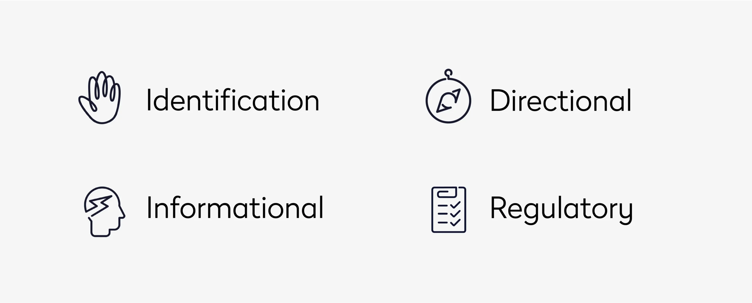
Identification, directional, informational, and regulatory signage still provide the physical foundation. But complex facilities increasingly need those signs to work alongside digital floor plans, mobile navigation, booking systems, visitor workflows, and current information about how space is being used.
The goal is no longer simply to point people in the right direction. It is to maintain a reliable connection between people, place, and changing workplace conditions.
Key takeaways
- The four types of wayfinding signage are identification, directional, informational, and regulatory, but enterprise wayfinding depends on how those layers work together
- Flexible seating and frequently changing workplaces make static navigation information harder to maintain as the sole source of guidance
- Digital wayfinding becomes more useful when it connects navigation with booking, visitor workflows, and current space information
- Consistent spatial data is critical. Room names and floor plans need to align across physical signage and the systems employees use
- Wayfinding data can also reveal friction in the workplace, giving facility teams another source of insight for space planning and utilization decisions
Signage vs wayfinding
Wayfinding is the system people use to understand their position within a physical environment, determine where they need to go, and move between those points.
The distinction between signage and wayfinding matters.
A sign is an individual communication tool. Wayfinding is the larger navigation architecture around it. It includes environmental cues, spatial hierarchy, floor plans, naming conventions, physical signs, digital maps, and increasingly the workplace systems that understand where people and resources are located.
Our guide to wayfinding and workplace navigation looks at this broader model, including the relationship between signage, digital maps, mobile navigation, accessibility, and workplace-system integrations.
For facility teams, that broader view changes the question from “Where should we install signs?” to “What information does someone need at each stage of the journey, and which system should provide it?”
That distinction becomes particularly important in workplaces that no longer operate around permanently assigned locations.
Why static navigation breaks down in dynamic workplaces
Traditional wayfinding assumes a relatively stable relationship between people and place. Departments occupy known floors. Employees sit at familiar desks. A directory can remain accurate for months or years.
Flexible workplaces challenge those assumptions.
An employee might book a different desk depending on who else is onsite. Project teams can temporarily occupy neighborhoods. Conference rooms may change function, while office moves alter circulation patterns without changing the building itself.
The physical environment might remain recognizable while its operational context changes continuously.
This creates a version-control problem for wayfinding.
When floor plans, room names, reservations, signs, and employee-facing applications are maintained independently, inconsistencies become more likely. A navigation strategy therefore needs governance as much as good design.
Facility teams need to know which system owns spatial information, how changes propagate to other applications, and who is responsible for keeping physical and digital representations aligned.
The four types of wayfinding signage
The traditional four-part model remains useful because each signage type answers a different question during the journey.
The more important consideration for complex facilities is how those layers connect.
- Identification signage: establishing a common spatial language
Identification signage answers: Have I reached the right place?
Room plaques, department markers, floor identifiers, amenity labels, and landmark names are familiar examples.
At enterprise scale, however, identification is also a data-governance issue.
Consider a room identified as “4E-214” in a facilities database, “Atlanta” in the booking system, and “Conference Room 12” on the door. An employee may technically have access to accurate information at every stage and still struggle to find the room.
The problem is not signage quality. It is inconsistent location identity.
Organizations managing multiple floors or buildings need naming conventions that translate across physical and digital environments. A person searching for a room in an app should be able to recognize that same destination when they reach the door.
This becomes even more important when location data feeds booking, visitor management, maintenance, workplace analytics, or other connected workflows.
- Directional signage: managing decisions, not just routes
Directional signage answers: Which way should I go from here?
Arrows, corridor signs, elevator directories, floor graphics, and overhead markers all serve this purpose.
Effective directional design is built around decision points rather than distance alone.
A long corridor with no intersections may require little guidance. A short journey involving two elevator banks, controlled access, and a split corridor can require considerably more.
Facility teams can therefore evaluate directional signage by looking at decision density: where does someone have to choose a route, and what information do they have when making that choice?
Digital navigation introduces another consideration. Physical signs and digital routes should reinforce each other.
If an app tells someone to proceed toward “North Collaboration Zone,” that terminology needs to mean something when they look up from their phone. Digital guidance should not create a parallel navigation language that exists only on a screen.
- Informational signage: controlling information load
Informational signage answers: What do I need to know about this environment?
Directories, floor maps, amenity information, operating hours, parking instructions, and facility notices fall into this category.
The challenge is usually not a lack of information. It is prioritization.
A lobby directory can contain every destination in a building and still perform poorly if users cannot identify the relevant one quickly. Effective informational wayfinding considers what someone needs at that point in the journey, rather than treating every sign as an opportunity to display everything available.
Digital directories can change that relationship.
Search allows users to request a specific destination instead of scanning an exhaustive list. Interactive maps can show the destination in spatial context. When connected with current workplace information, digital interfaces can potentially distinguish between merely showing where a resource exists and helping someone find one that is actually useful to them.
- Regulatory signage: separating mandatory information from general guidance
Regulatory signage communicates requirements rather than suggestions.
Accessible route markers, restricted-access notices, occupancy limits, hazard warnings, and emergency instructions are examples.
These signs can be subject to accessibility requirements, building codes, safety standards, or other regulations, which means design flexibility may be more constrained than it is elsewhere in the wayfinding system.
The strategic challenge is ensuring regulatory information remains both compliant and distinguishable.
A workplace saturated with visual messaging can make important instructions harder to identify. Regulatory information needs enough visual priority that users can recognize it quickly, particularly when it relates to emergency movement or access restrictions.
Digital navigation can supplement this information, but it should not create dependencies that undermine required physical safety communication.
The real challenge is connecting the four layers
Organizations can execute all four signage categories correctly and still create a poor navigation experience.
The reason is fragmentation.
A visitor might follow excellent directional signage to a department that has moved. An employee might find a correctly labeled meeting room that is unavailable despite appearing free elsewhere. A beautifully designed directory can still be wrong after a floor reconfiguration.
Modern wayfinding therefore needs to address information consistency between layers, not just the quality of each individual sign.
This is where the distinction between signage and a wayfinding system becomes much more meaningful.
Digital wayfinding creates a dynamic navigation layer
Physical signage is strongest when the information is stable. Digital wayfinding becomes valuable where context changes.
Interactive floor plans can make destinations searchable. Kiosks can give visitors a visual reference before they enter unfamiliar parts of a building. Mobile tools can carry navigation with the user instead of requiring them to find the next directory.
The important differentiator is not simply replacing printed information with a screen.
It is the ability to connect navigation with the workplace systems that already know something about the destination.
Eptura’s wayfinding capabilities, for example, can connect interactive maps with room and desk booking, visitor management, and workplace information. Wayfinding can also be delivered through different endpoints, including mobile devices and kiosks, rather than requiring organizations to build navigation around a single hardware environment.
That approach matters for enterprise portfolios where buildings may have different display hardware, layouts, and technology requirements.
The architecture can remain consistent even when the physical implementation varies.
Mobile wayfinding changes where the journey begins
For hybrid employees, workplace navigation can begin before the commute.
Someone may first decide whether to come into the office based on who else will be there. They reserve a desk, identify where their team is sitting, and later need directions from the building entrance to that workspace.
Those are often treated as separate tasks. From the employee’s perspective, they are one journey.
Connecting navigation with booking makes that journey more coherent. Eptura’s workplace app, for example, supports floor-plan navigation alongside finding and reserving available desks and meeting rooms, locating common areas, and finding colleagues where appropriate.
That distinction becomes important as workplaces shift from assigned seating to shared resources.
The employee does not just need to know where desks are. They need to know where their reserved desk is.
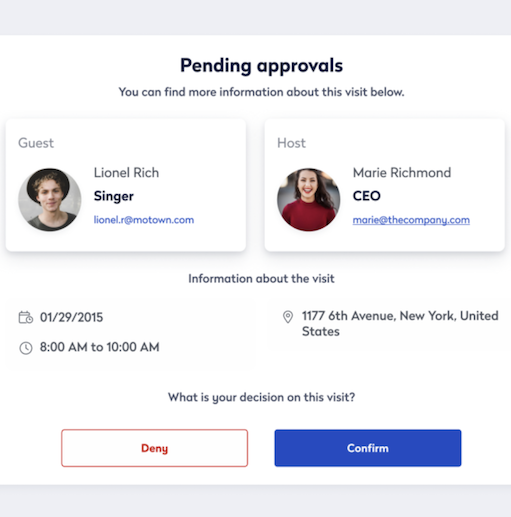
Visitors create another version of the same problem. Their journey can begin with pre-registration and continue through arrival, check-in, host notification, and navigation through an unfamiliar facility.
When visitor management and wayfinding are disconnected, the visitor effectively has to restart the journey after checking in.
Real-time context changes the value of a map
A floor plan is an inventory of what exists. A workplace map connected to operational information can answer a more useful question: What can I use right now?
Imagine two employees looking for a four-person meeting room.
A static map can show every four-person room on the floor. A connected experience can account for current bookings or availability and help the employees focus on spaces that can actually meet their need.
That is a meaningful difference because navigation is no longer separated from resource allocation.
Eptura’s office wayfinding capabilities connect maps with nearby space status and booking, while its workplace experience tools can incorporate presence information to improve the accuracy of space availability.
For workplace teams, this also creates an opportunity to look at navigation from the opposite direction.
Instead of asking only whether people can find spaces, teams can investigate which spaces people repeatedly seek out, which routes attract traffic, and whether certain resources remain difficult to discover.
Those patterns can contribute to a richer understanding of workplace utilization.
Wayfinding needs a spatial source of truth
The sophistication of a digital interface matters less if the underlying spatial information is unreliable.
This is one of the most important distinctions between basic digital signage and enterprise wayfinding.
Room names, floor plans, amenity locations, and space classifications can feed several workplace processes. When each application maintains its own interpretation of the building, discrepancies eventually appear.
A shared spatial foundation reduces that risk.
It allows the same representation of the workplace to support employee navigation while also informing booking and longer-term space decisions.
This is particularly valuable during workplace change.
If a floor is restacked, the impact should not stop with the planning team. The employee-facing representation of that floor needs to change too. Otherwise, workplace planning moves faster than workplace experience.
Accessibility requires route-level thinking
Accessibility in wayfinding goes beyond making individual signs compliant.
The complete route matters.
A digital map may identify an accessible entrance but still direct someone toward a path containing an obstacle. A physical sign may satisfy visual requirements while the information hierarchy remains difficult to process. A touchscreen kiosk can provide excellent navigation for many users but become a barrier if there is no accessible alternative.
Effective design therefore considers equivalent navigation experiences, not identical interfaces.
Physical wayfinding may incorporate Braille, tactile characters, high-contrast text, accessible mounting heights, and clear symbols. Digital experiences can extend accessibility through screen-reader compatibility, accessible interfaces, or alternative route information.
Multilingual environments introduce another layer. Symbols and consistent spatial naming can reduce reliance on lengthy written directions, particularly in global workplaces and facilities serving large visitor populations.
Accessibility should influence the navigation architecture from the beginning rather than being applied after the main system has already been designed.
Wayfinding can expose hidden workplace friction
Most organizations measure space in terms of capacity, occupancy, or bookings.
Wayfinding introduces another question: How easy is that space to actually use?
A meeting room can be technically available and still provide little value if employees routinely struggle to locate it. A collaboration zone can have appropriate capacity but remain underused because it sits outside normal circulation patterns.
Navigation behavior can therefore add context to utilization data.
If employees repeatedly search for the same amenities, that might indicate poor visibility. If certain destinations generate frequent requests for directions, the issue could be naming, placement, or route complexity.
This does not mean every navigation interaction should trigger a space-planning decision.
It does mean workplace teams can use wayfinding as another signal when investigating why actual behavior differs from expected use.
Better wayfinding can reduce the operational cost of confusion
The cost of poor navigation rarely appears as a dedicated line item.
Instead, it shows up in small interruptions.
Reception answers directions that could have been self-service. Meetings begin late because attendees went to the wrong room. Facility teams field questions about locations that should be easy to identify.
These are difficult costs to quantify individually, but they reveal an important principle: workplace friction often shifts work from the person experiencing the problem to someone else.
Effective wayfinding reduces that transfer.
For employees, that can mean greater independence in unfamiliar offices. For visitors, it can reduce reliance on reception. Facility teams spend less time compensating for information gaps.
Wayfinding data can inform space planning
The relationship between wayfinding and space planning becomes more interesting when organizations stop viewing navigation as a one-way service.
Navigation helps people use the workplace, but their behavior can also provide information about the workplace.
Suppose two collaboration areas offer similar capacity, yet one receives significantly more traffic. The difference might be location, proximity to team neighborhoods, visibility, or easier navigation.
Those possibilities cannot be understood from occupancy percentages alone.
Combining navigation patterns with booking and utilization data gives workplace teams more context for interpreting behavior.
That can influence decisions about signage, circulation, amenity placement, or future space configurations without assuming that low utilization automatically means low demand.
Building an enterprise wayfinding strategy
A mature wayfinding strategy begins with journeys and data ownership, not sign procurement.
Audit decision points, not just signage
Traditional signage audits often document what signs exist and whether they meet design standards.
A navigation audit should also identify where people have to make decisions.
Walk common routes from parking and transit entrances, reception, elevators, shared work areas, and other high-traffic points. Look for moments where someone unfamiliar with the building would lack enough information to confidently continue.
Those moments reveal gaps that a simple signage inventory can miss.
Establish spatial data governance
Determine where authoritative room names, floor plans, and location information live.
Then identify which systems consume that information.
When a room changes, teams should understand how that update reaches booking systems, digital maps, visitor tools, and physical signage.
Without ownership, navigation accuracy tends to deteriorate gradually rather than fail all at once.
Design around change frequency
Different information has different lifespans.
Building identification may remain unchanged for decades. Team neighborhoods might change several times a year. Room availability changes by the minute.
The wayfinding medium should reflect that.
Stable information is well suited to physical signage. Frequently changing information benefits from digital delivery, particularly when it can draw from an existing operational system instead of requiring manual updates.
Test the journey with unfamiliar users
People who work in a building every day unconsciously compensate for poor wayfinding.
They know which elevator to take and which conference room has an unusual entrance.
That makes them poor proxies for first-time users.
Testing with new employees, visitors, or people from another office can reveal navigation assumptions that long-term occupants no longer notice.
Measure friction, not just engagement
Digital wayfinding platforms can generate usage data, but high engagement does not automatically indicate success.
If people repeatedly search for the same room because they cannot find it, high search volume may actually reveal a problem.
Useful measures can include time to destination, repeated searches, common destinations, front-desk direction requests, employee feedback, and areas where navigation consistently breaks down.
The objective is not to maximize interactions with wayfinding technology. It is to make the workplace easier to navigate.
Common wayfinding mistakes that become expensive at scale
One outdated room name is inconvenient. Hundreds of inconsistencies across a global portfolio become a governance problem.
That is why enterprise organizations should pay particular attention to errors that compound:
- Maintaining different room names across booking systems and physical signs
- Treating digital signage as a standalone display project
- Updating floor plans without updating employee-facing navigation
- Designing around organizational charts instead of real user journeys
- Assuming a successful headquarters implementation can be copied unchanged into every building
- Collecting navigation data without connecting it to broader workplace analysis
- Adding new technology without establishing ownership for the underlying spatial data
The underlying pattern is fragmentation.
The more systems that depend on workplace location information, the more important it becomes to manage that information consistently.
The future of wayfinding is contextual
The next stage of wayfinding is not simply a more detailed map.
It is navigation that understands intent.
An employee does not necessarily want directions to “Room 412.” They may want somewhere nearby for an unscheduled conversation. Another employee may want a desk close to colleagues who are onsite that day.
Indoor positioning systems can make location guidance more precise inside large buildings. Digital twins can provide richer spatial models, while occupancy information adds another layer of context.
AI could change how people query those systems.
Instead of navigating through filters, an employee could ask for an available six-person room near their team and receive an appropriate option with directions.
But that experience depends on what sits underneath the AI.
If booking data is stale, room names conflict, or the floor plan is inaccurate, a conversational interface simply delivers bad information more elegantly.
The competitive advantage will therefore come less from the interface itself and more from connected, trustworthy workplace data that gives intelligent navigation something reliable to reason over.
From signage to workplace infrastructure
The four types of wayfinding signage still matter. Identification confirms place. Directional signage manages movement. Informational signage adds context, while regulatory signage establishes required boundaries and safety information.
The larger opportunity is in what connects them.
As workplaces become more flexible, organizations need navigation systems that can keep pace with changes in space and employee behavior. Digital maps and mobile navigation can make workplace information easier to access, but their value increases when they connect with the systems already managing bookings, visitors, and space.
That changes wayfinding from a collection of visual cues into part of the workplace’s operational infrastructure.
For employees and visitors, that complexity should remain mostly invisible. They should simply be able to find the right place with confidence.
For facility and workplace teams, the work behind that experience is increasingly sophisticated: maintaining accurate spatial data, connecting systems, measuring friction, and ensuring the digital representation of the workplace keeps pace with the physical one.
Frequently Asked Questions

By Amanda Meade
Amanda Meade is a content creator at Eptura, specializing in workplace experience, meeting productivity, and emerging trends in workspace planning and visitor management. With a background in content marketing and SEO, she crafts clear, actionable content that helps teams work smarter through in-office collaboration. Throughout her career, Amanda has worked across industries, including home services, healthcare, real estate, and SaaS, developing a unique ability to distill complex topics into practical insights.